How you can use this image
This image can be used for non-commercial research or private study purposes, and other UK exceptions to copyright permitted to users based in the United Kingdom under the Copyright, Designs and Patents Act 1988, as amended and revised. Any other type of use will need to be cleared with the rights holder(s).
Review the copyright credit lines that are located underneath the image, as these indicate who manages the copyright (©) within the artwork, and the photographic rights within the image.
The collection that owns the artwork may have more information on their own website about permitted uses and image licensing options.
Review our guidance pages which explain how you can reuse images, how to credit an image and how to find images in the public domain or with a Creative Commons licence available.
Notes
Add or edit a note on this artwork that only you can see. You can find notes again by going to the ‘Notes’ section of your account.
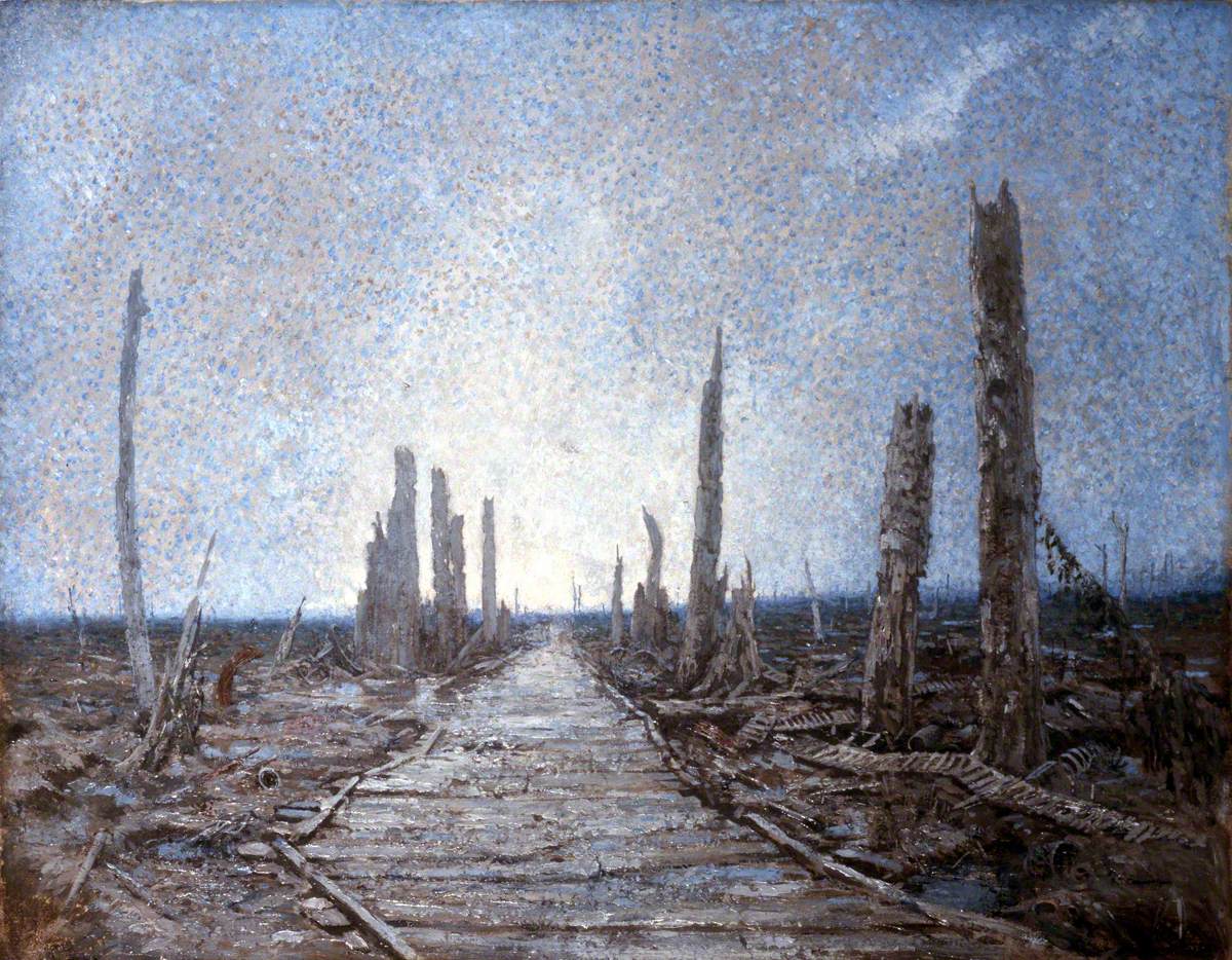
Although painted some years after the event, this scene was the work of an eyewitness who served through the entire conflict and was typical of the devastated landscape of the Western Front during the First World War (1914–1918). ‘Warrington Road’ was a track in the Ypres Salient, running from Shrapnel Corner on the Lille Road out of Ypres, past Zillebeke Lake, to the mid-point on the road between Hell-Fire Corner and Zillebeke village. Like ‘Regent Street’, and ‘Rotten Row’ in Plugstreet (Ploegsteert) Wood, it demonstrates the troops’ habit of giving nicknames to well-travelled routes. Little more than duckboard walkways through featureless, muddy landscapes, such ‘roads’ were often the only way to pass, even at the risk of being shot at by snipers.
Title
Warrington Road, 1917
Date
c.1926
Medium
oil on paper
Measurements
H 55 x W 71.1 cm
Accession number
NAM. 1992-12-45
Acquisition method
gift from Mr Adrian T. Cooper, 1992
Work type
Painting
